 In researching these pieces, there are a few sources to which I keep coming back. One of the oldest of these is a map drawn and printed in 1857, almost certainly the oldest of these sources. Today, I will look a little at this map and the man who made it.
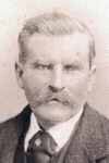
Albert Boschke (pictured) was born in 1823 in Germany. He came to the United States and soon joined the Coast and Geodetic Survey. However, he seems to have become more interested in a project that was not, strictly speaking, in his purview: That of creating an accurate map of the District of Columbia, which he hoped to sell to the government. Neglecting the tasks nominally set for him, he went out with a number of helpers and surveyed the city. According to an article published in National Geographic in 1895, his neglect of the work he had been hired for ended in “his enforced resignation from the survey.”
In 1857, the fruits of his labor were published by Bien & Company of New York. Shortly thereafter, the Washington Evening Star described the map
Nothing like this map has yet been got up of this city as regards beauty of execution, and a minute accuracy of detail of every particular of streets, lanes, water courses, elevations, depressions, land marks, boundaries, &c. […] It is moreover sold at a price which places it within the reach of all. The amount of labor requisite to get up such a map is almost frightful to think of, and how it cane be made to pay expenses at the price for which it is sold is more than we can guess.
While the Star comments on the maps accuracy, the National Geographic article points out that Boschke was mistaken in the certain measurements that he had used, making the map slightly incorrect.
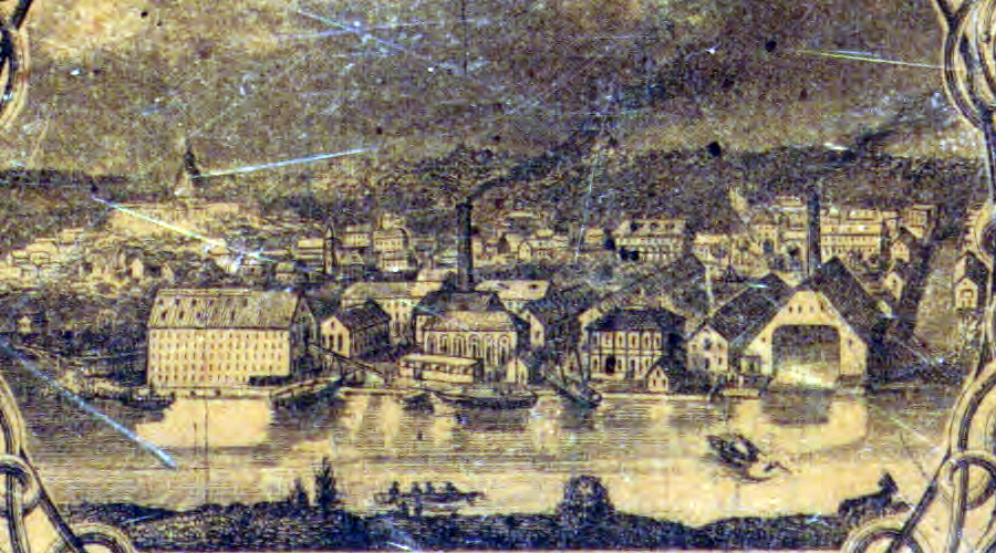
Boschke’s map was surrounded by a series of vignettes showing the District, including this on of the Navy Yard. (LOC)
This minor glitch did nothing to lessen the success of the map and Boschke now went on to create a second version of his map, which included not just the city of Washington, but all of the District of Columbia. He finished this just as the Civil War was breaking out, and since the government had no topographic map of the District, Boschke sold his interest to three others, who then in turn sold it to the government – a procedure which took some time as the owners were convinced that their work should be valued at $20,000, while Secretary of War Edwin Stanton felt that $500 was a more appropriate price. In the end, the plates changed hands for $8,500.
Boschke moved out west, where he switched to dredging work. He lived until 1910.
If you want a copy of Boschke’s original 1857 map today, you’re out of luck. Only three copies have been put up for sale in the last 50 or so years. However, a number of copies are held by the Library of Congress, and they are free to download, both in the 1857 and the 1861 variants. And I will continue to use them to research and illustrate my writings as long as I keep this up.