A few weeks ago (and, I’m sure multiple times in the past) I referred to a street as “F street north,” which of course makes no sense in the current street numbering scheme. I thought it might be wise to have a quick explainer as to how houses used to be referred to and how that changed over the years.
In the very early days of the city, there was pretty much no need for addresses. Buildings were simply referred to by what them were close to, i.e. “Tomlinson’s tavern, near the Capitol” was a perfectly clear description.
As the city grew, it became necessary to be more specific when referring to its multiplying buildings, so when Judah Delano published the first city directory of Washington in 1822, he located each house by its cross streets, so one entry would read “Otterbach Phillip, butcher corner Ms and 9e N Yrd” which translates to “corner of M Street South and 9th Street East near the Navy Yard.” Houses in the middle of a block were given in a similar way “Carroll Daniel, of Duddington, south of Es btw 1 and 2e” which translates to “south of E Street South between 1st and 2nd Streets East.” Sometimes, they include the information that the house was the second house from the corner or other ways of finding it.
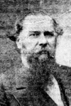
Obviously, this worked only so far. As the city expanded, there was a need for more accurate numbering, and somewhere in the mid 1850s, houses were given numbers, and when William H. Boyd [pictured] published his first city directory in 1858, the inhabitants are listed in this way.
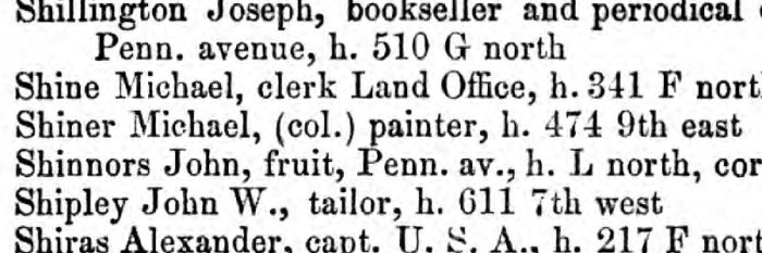
Thus, the entry for Michael Shiner reads “Shiner Michael, (col.) painter, h. 474 9th east” While the “(col.”) means exactly what you think it does, the rest requires some explanation. The numbering scheme for streets that stretched from north to south actually began from the north end, in this case Boundary Road – what we would today call Florida Avenue. However, the numbering did not proceed by the “Philadelphia plan,” in other words one hundred numbers per block. Thus, if you wanted to find Mr. Shiner, you would have to start somewhere on 9th Street and then just follow the numbers until you got to number 474.
Things got a little better after the Civil War, with the publishing of the 1867 city directory. In it was a “Washington Street Directory” that listed all the streets in the city and what path it took. Thus, 9th Street East is entered as “9th East, fm Boundary to East’n Branch.” Below that, were two sets of numbers next to 9th’s cross streets: The numbers left and right as you reach that street. Thus 474 is listed as being at D Street.
However, anyone looking for Mr. Shiner would be way ahead of you already. For some reason, this edition of the City Directory reverts to the old format, listing his address as the corner of 9th East and D South.
Since the City Directory was some 650 plus pages long, it was not like you were going to carry it around when making your way around the city. There had to be some better way of numbering the houses to make it easier. And, in the late 1860s, that was exactly what happened.
Next week: A better way.